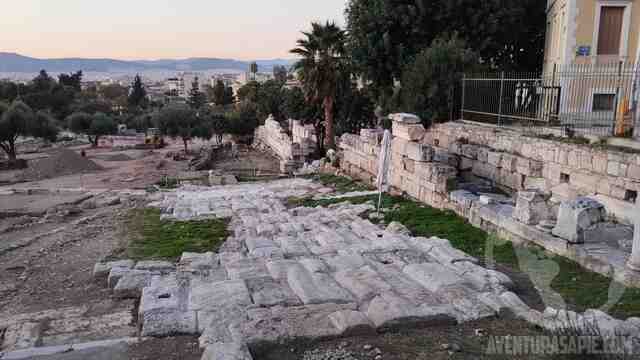
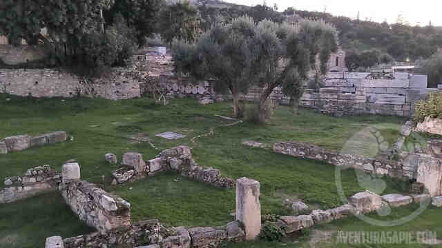
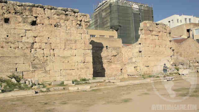
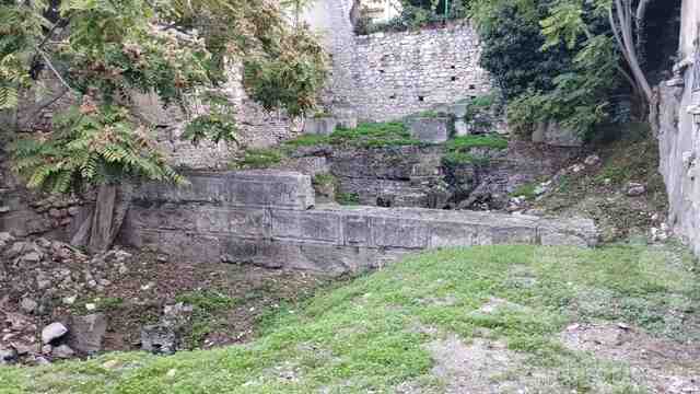
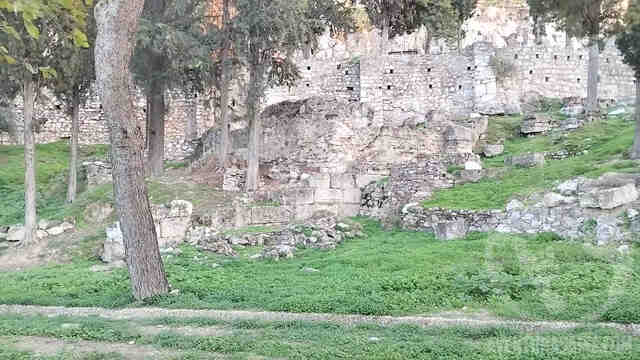
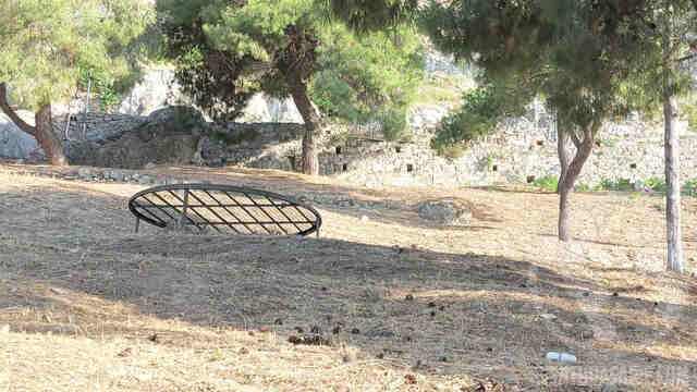
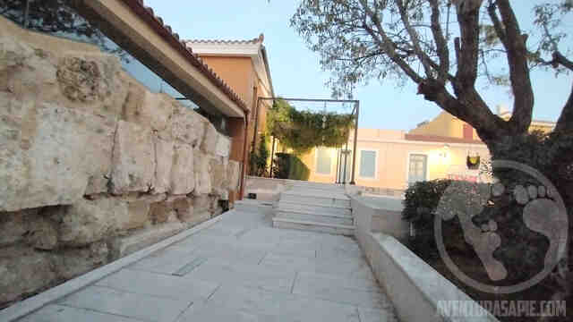
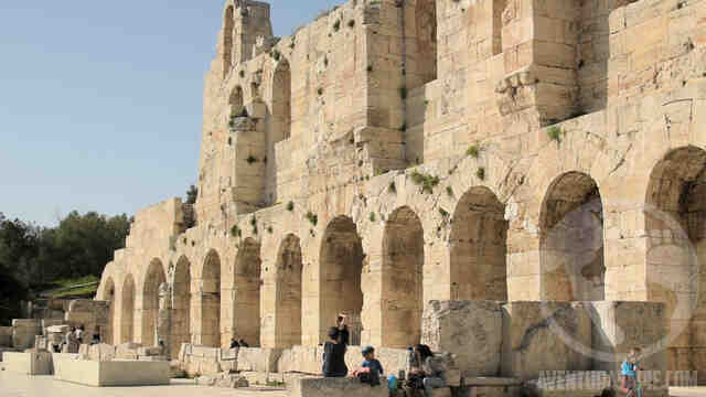
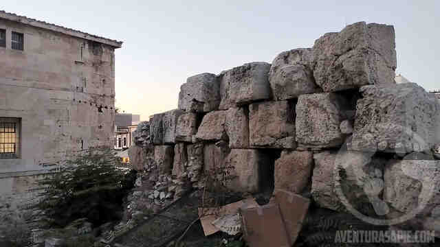
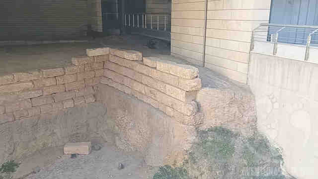
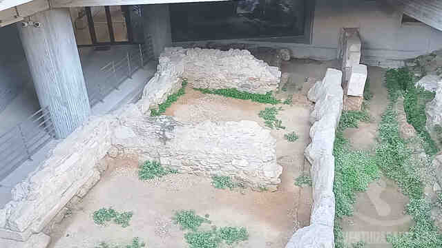
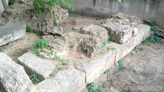
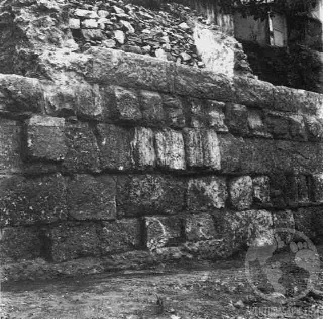
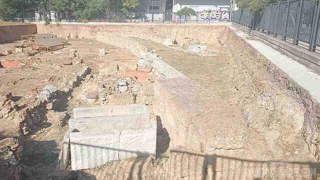
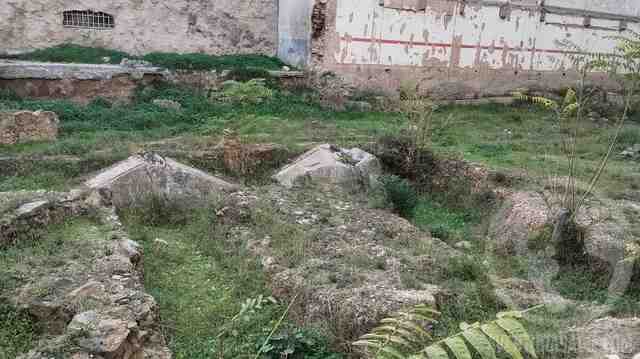
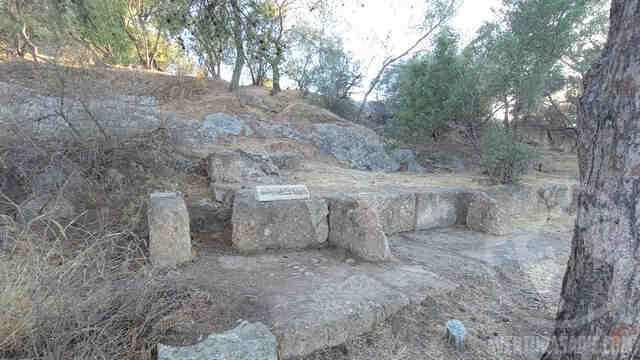
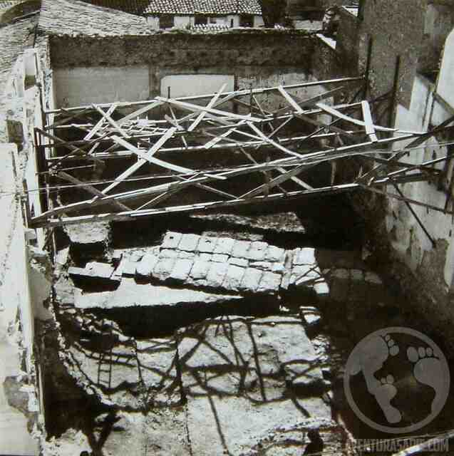
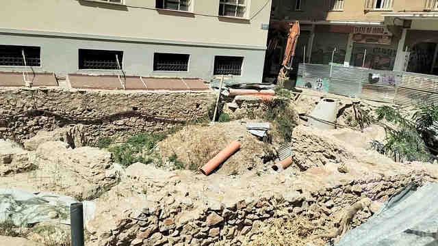
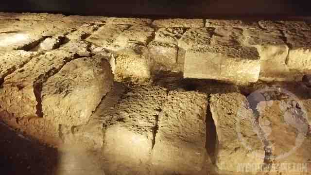
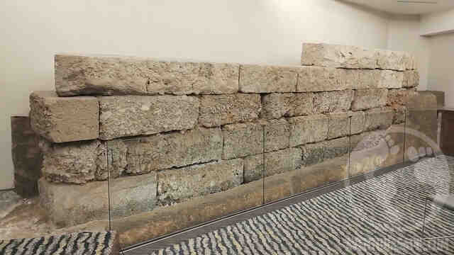
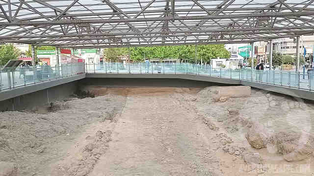
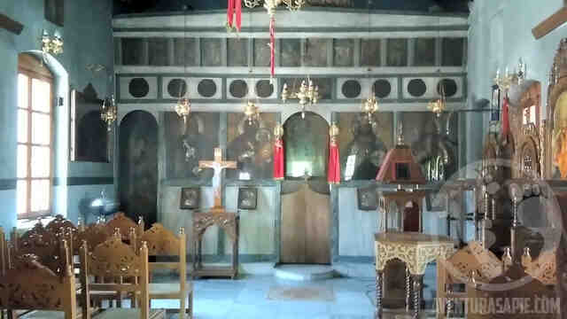
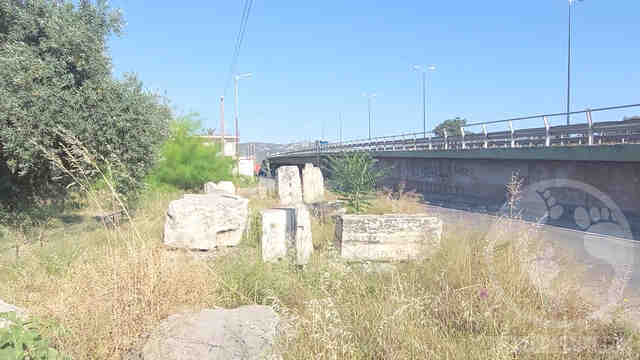
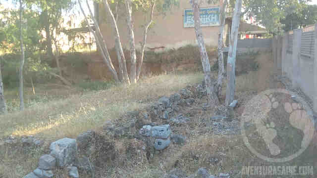
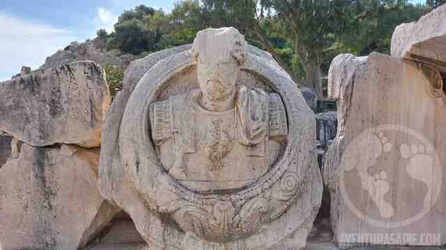
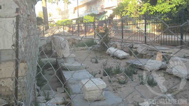
In this audio guide, we primarily explore the remains of the late Roman wall of Athens, also known as the Herulian or Post-Herulian Walls, which were built in 280 AD after the city’s destruction in 267 AD by the Heruli, a barbarian people from Scandinavia.
This event was so destructive and traumatic that it was decided to reduce the city to a small fraction of its former size.
On this tour, we will see not only all the visible fragments of the wall but also other monuments, sharing interesting details about them.
The audio guide includes an audio and text description of each point, as well as current and historical photos of the site.
In which format are available the audio guides and maps?
Our maps and audioguides are available in GPX format, which is one of the most common track formats for GPS devices and they can be opened by most map apps.
In our case, we have embedded the audio tracks inside the file, so they can be used without Internet access and this is the reason why our GPX files are larger than usual and they cannot be opened with most map apps.
Which apps can I use to open the audioguides?
We recommend “OrganicMaps“, because it is free, lightweight, fast, open source (which is more secure) and because it supports large files.
Also, there is a new app called CoMaps, based on OrganicMaps. We are testing it at the moment and it is likely we will recommend it in the future.
Our maps also work with OsmAnd~ , but we do not recommend because it consumes more resources and you need more clicks to listen to each audio.
Which apps can not be used?
We have tested our audio guides with a few other apps and we can confirm they cannot be used.
“Maps.me”: Doesnt support GPX files.
“Locus Map 4 Outdoor Navigation”: Has issues the file size.
Feel free to test our audio guides with other software and let us know the results.
Is there an audio guide that I can try out for free?
Yes, we are offering a free audio guides, with a small tour around the Acropolis, where we explain why it has been the center of Athens through millennia.
To download it, go to our Shop (at ko-fi.com), and complete the amount to donate with 0€.
The audios and images are in the description of each point.
To access the description, there are 2 ways: first, clicking in the point on the map; and the second option is opening the the bookmark list, choosing the audio guide and then the point of interest.
I want to see the name of each point on the map. Can I do that?
Yes, with OrganicMaps is very easy. Go the config menu, and activate Bookmark names on the map. Here we will have 3 options: Hide, Show to the right y Show at the bottom. Here we have to choose one of the last 2 options.
If you find the font size too small, you can increase the font size, going back to the configuration and activating Increase size for map labels.
The points of interest are not in sequential orden. Is there a way to order them?
Yes, with OrganicMaps it is possible. Go to the bookmark menu, click on the audio guide and choose Sort, and then, choose By Name.
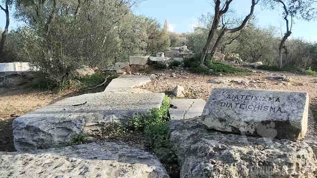
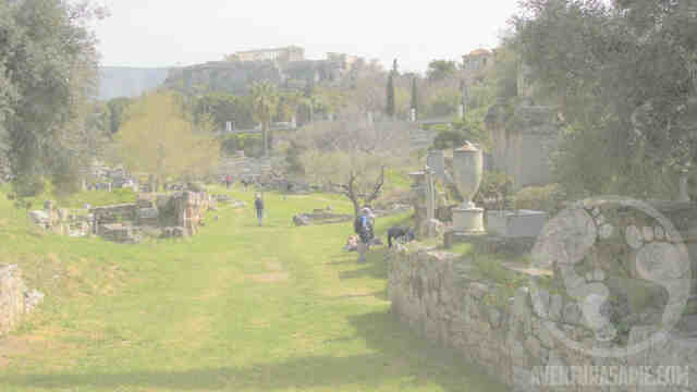
In this audio guide, we mainly explore the remains of the walls that Athens had: the wall of Themistocles, the Proteichisma wall, the Diateichisma wall and the wall of Valerius, as well as mentioning the Haseki wall, which was the most modern wall that Athens had, built in 1778.
The audio guide has an audio and text description of the site, as well as current and historical photos of the site.
Distance: 10km
Time: 6h
Note: There is another audio guide where we explore the remains of the smaller walls, mainly the Post Herulian wall, built after the sack of Athens by the Heruli in 267 AD and the Rizocastro wall of the early thirteenth century.
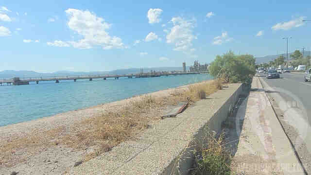
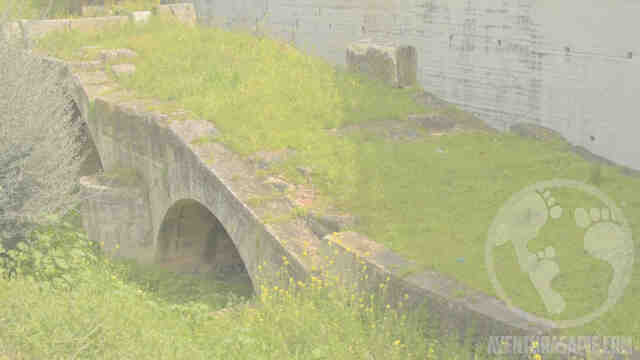
The Long Walls of Athens, also known as “Makra Teixi,” were a defensive structure that protected the access road between Athens and the Port of Piraeus. They were 7 kilometers long, between 3 and 4 meters high, and consisted of two parallel walls, spaced about 200 meters apart, and were protected by towers. The protected area included not only the road connecting the two cities but also houses, sanctuaries, shops, and even cemeteries.
They were commissioned by the famous general Themistocles in the 5th century BC to guarantee access to the sea in case of a siege. This audio guide follows this ancient road, exploring the still-visible remains, many of which are hidden and undocumented.
The audio guide is a walking route of about 11 kilometers, where we will visit more than 30 points of interest. It will take approximately 4 to 5 hours to complete the entire route. Furthermore, it’s very easy to split your trip into two or more days, if needed, using the green metro line.
Athens is a city with over 3,000 years of history, having been inhabited by the Mycenaeans, the ancient Greeks, the Romans, the Byzantines, and the Ottomans. It boasts a great number of sites, some little known, from which to admire this magnificent city.
That’s why we decided to compile a list of viewpoints that includes not only the best spots to appreciate the Acropolis and the surrounding area, but also other interesting, hidden, and little-known viewpoints, offering a different perspective of the city.
This list includes the typical viewpoints of Areos Pagos, Philopappos, and Lycabettus, plus other lesser-known vantage points.
Some are rooftop cafes, and some belong to museums. Often, it’s possible to ask permission to visit the cafe without paying the museum entrance fee, and it’s also possible to enjoy the view without buying a coffee.
The list also includes viewpoints that are difficult to access by public transport, such as those on Mount Parnitha and Mount Hymettus.
You can find the map at this link: https://ko-fi.com/s/318abe4026
Athens, upon arrival, can be a challenging city due to the lack of a common language and alphabet.
The most common tool for navigating the city is a mobile phone with an internet connection.
However, it’s possible that our phone, for one reason or another, doesn’t have internet access, such as:
We forgot to enable roaming before leaving our country (required by some phone providers)
Our plan doesn’t cover roaming (a surprise that has happened to me personally)
We’re coming from outside Europe and roaming is prohibitively expensive.
In these situations, it would be ideal to know where to find free Wi-Fi to reply to messages and emails, download maps, and check the location of our hotel.
This list includes the most well-known establishments that provide free and open Wi-Fi, which are:
Some international food chains like McDonald’s and local chains like BreadFactory
Some cafes and bakeries like La Pasteria, 12oz, and Apollonion
Some international supermarket chains like LIDL and local chains like AB Bassilopoulos and Massoutis
Many bank branches
Some metro stations of tourist interest, in their main halls, such as Syntagma, Acropolis, Omonia, Piraeus, Neratziotissa, and Doukissis Plalentias (currently being installed in all stations)
Large stores like Public, Plaisio, and Hondos Center
Large department stores like Leroy Merlin and Praktiker
Some parks and public squares.
All shopping malls (although there aren’t any in the center of Athens)
Some clothing chains, such as Terranova, Zacret, Zara, H&M, JD, Adidas, Guess, Cosmos Sports, Marks & Spencer, Intersport, and Slam Dunk. Stores like Pull&Bear and Nike may ask for your name and email address.
Eleftherios Benizelos International Airport
Gas stations like AVIN
Libraries and cultural centers like Stavros Niarchos
And more that we found while wandering the streets…
In addition, the vast majority of cafes and restaurants have their own Wi-Fi, protected by a password, so you can order a coffee and ask for the password.
We know that other providers of free Wi-Fi hotspots exist online, but unfortunately, they are not up to date.
If you find free Wi-Fi hotspots during your trip that are not on this list, please let us know and we will add them.
To access this collection of points of interest, you need an offline map app.
In addition, most cafes and restaurants have their own password-protected Wi-Fi, so you can order a coffee and ask for the password. We recommend OrganicMaps because it’s lightweight, fast, open source (it doesn’t spy on you), and supports large files. For more information, you can visit our FAQ section for maps and audio guides.
Athens, upon arrival, can be a challenging city due to the lack of a shared language and alphabet.
And like many cities, it doesn’t have a large or well-publicized public restroom infrastructure.
If you urgently need to use the restroom, you can always buy a coffee at a café and go there, although there are times when this is undesirable, perhaps because you’ve just finished a meal, don’t want to spend more money, or are in a hurry due to another commitment. For these reasons, it’s very useful to have an offline map showing the nearest public restrooms.
This list includes the most well-known establishments with easily accessible restrooms, which are:
Some international food chains like McDonald’s and local chains like BreadFactory
Some supermarkets belonging to the German chain LIDL and all supermarkets belonging to the Greek chain AB Bassilopoulos
All shopping malls (although there aren’t any in the center of Athens)
Some cafes in large department stores like Marks & Spencer and Public.
Bus stations, the ports of Piraeus and Faliro, and Eleftherios Benizelos International Airport
Large stores like Leroy Merlin, Praktiker, and IKEA, and the Jumbo chain (though not all locations)
In the center of Athens: the Roman Agora, the Acropolis Museum, and Philopappos Church
In public libraries, including the Stavros Niarchos National Library
In public universities
And more that we’ve found while wandering the streets…
If you visit any public restrooms during your trip that aren’t on this list, please let us know and we’ll add them.
To access this collection of points of interest, you’ll need an offline map app.
We recommend OrganicMaps because it’s lightweight, fast, and open source. For more information, you can visit our FAQ section for maps and audio guides.
In recent years, the trend of painting large murals as a way to beautify cities has become popular, and Athens has embraced this trend wholeheartedly. Many tourists enjoy this open-air gallery; however, no organization had yet created a map documenting the locations of these works, which is what we have done.
This map includes murals by renowned Greek artists, as well as international artists such as INO, Soteur, Same84, Nikolaos Tsounakas, Aristeidis Lappas, Leonidas Giannakopulos, Robert Vargas, Alex Martinez, Billy Gee, Tristan Eaton, STMTS, Ruin, Cacao Rocks, Taxis, Paparazzi Art Studio, Mister Achilles, Eleni Psyllaki, Kes, Dreyk the Pirate, BirdCap, Kyle Holbrook, MiteArt, Chionis George, Platon, The krah, 101 Crew, Sotiris Fen, Koustenas, Lalas, Frank25, Barbadee, Onebran, Aleks, and more.
To access this collection of points of interest, you need an offline map app.
We recommend OrganicMaps because it’s lightweight, fast, open source (it doesn’t spy on you), and supports large files.
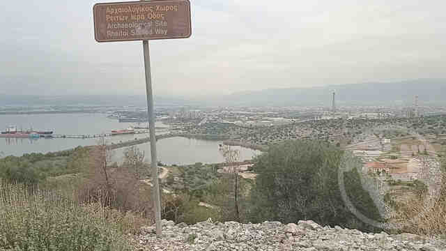
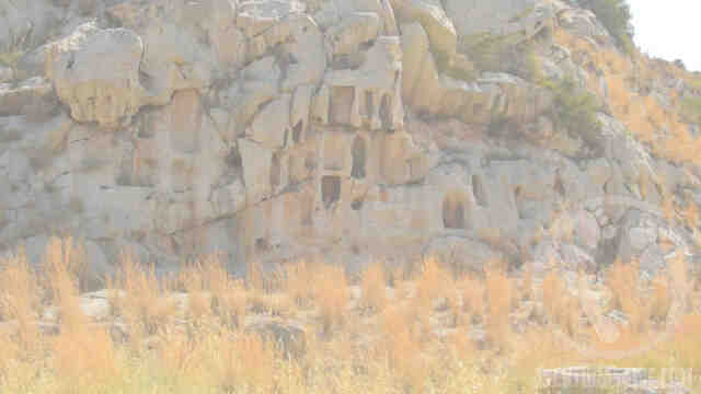
The Sacred Way was an ancient pilgrimage route between the cities of Athens and Eleusis to celebrate the Eleusinian Mysteries.
The Eleusinian Mysteries were initiation rites for the cult of the goddesses Demeter and Persephone, celebrated twice a year: the major celebration at the beginning of autumn and a minor celebration at the beginning of spring.
They are based on the myth of Persephone’s abduction by Pluto, who took her to live in the underworld, and the quest of her mother, Demeter, to rescue her.
It is believed that this pilgrimage was first undertaken during the Mycenaean period (1600-1100 BCE), although the worship of Demeter and the mysteries were officially established in Eleusis in the 8th century BCE.
The mysteries continued to be celebrated until the prohibition of pagan myths in the 4th century CE with the imposition of Christianity.
In this audio guide, we’ll visit all the relevant sites that remain to this day, as well as share some interesting but not essential details.
The route is approximately 25 km long and includes more than 30 points of interest. We estimate it can be completed in about 10 hours.
Do the tour from Wednesday to Sunday if you want to visit the Daphni Monastery.
Split it into two for easier planning: Keramikos-Agia Marina + Agia Marina-Eleusis or Keramikos-Dafni + Daphni-Eleusis
Additional Information:
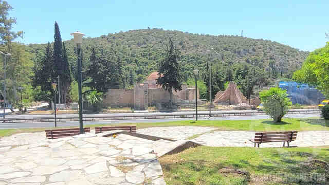
Keramikos Archaeological Site: (August 2025: Closed for renovations)
Dafni Monastery: Wednesday to Sunday, 8:30-15:30, Free Admission
Sanctuary of Aphrodite: Monday to Sunday, 8:30-15:30, Free Admission
Eleusis Archaeological Site: High Season: Monday to Sunday 8:00-20:00, admission €10 – Low Season: Wednesday to Monday 8:30-15:30, admission €5
To use this audio guide, you need an offline map app. We recommend OrganicMaps because it’s lightweight, fast, open source (it doesn’t spy on you), and supports large files. For more information, please visit our FAQ section for maps and audio guides.
If you’d like to try this audio guide system before purchasing, we offer a free audio guide of a walking tour around the base of the Acropolis.
Athens is a city with over 3,000 years of history, having been inhabited by the Mycenaeans, the ancient Greeks, the Romans, the Byzantines, the Ottomans, and countless other temporary invaders.
The remains of these early inhabitants, like so many other historic cities, lie underground, covered by modern buildings.
What almost no one knows is that many of these remains can be seen, if you know exactly where to look.
In this audio guide, we’ll travel back in time to Ancient Athens and explore its ruins in a very unusual way, using the blue metro line, stopping at 9 stations, and visiting at least 14 points of interest.
This audio guide lasts between 60 and 120 minutes, including travel time between stations.